Stage 2 – Geography – The Earth’s Environment – Exploring Panboola
Program Overview
Panboola Wetlands and Heritage Project offers a unique fieldwork experience for students learning about the Earth’s Environment. Panboola, which lies to the south of the Pambula township on the Far South Coast, is a long-term rehabilitation project that began over 20 years ago. The site is now a diverse estuarine and freshwater wetland comprising billabongs, saline areas, a tidal channel, tidal mud flats, mangroves and saltmarsh. This area provides habitat for a large range of animals including birds, mammals, fish and invertebrates.
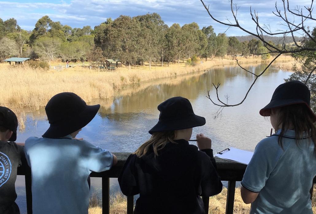
Within the 82-hectare project, students can identify a variety of different types of natural habitats e.g. floodplain forest, freshwater billabong, saltmarsh, shrubland as well as agricultural land. Bird surveys have been conducted in each of these ecosystems over the 20-year rehabilitation period of Panboola and this data allows students to discover the importance of natural vegetation to animals and the functioning of the environment. During an exploration of the site students will record their own data on bird and other animal species and their habitats as well as investigating the ways people value environments differently and how environments can be managed and used sustainably.
During the day’s activities students will use geographical tools appropriate to their stage to acquire, process and communicate geographical information. This will include maps, fieldwork, graphs and statistics, spatial technologies and visual representations.
Key Questions
- How does the environment support the lives of people and other living things?
- How do different views about the environment influence approaches to sustainability?
- How can people use places and environments more sustainably?
Learning Experiences and Content
Protection of environments
Students will investigate the sustainable practices that have led to the protection and rehabilitation of the Panboola site. By examining photographs and data collected over the last 20 years students can see how people can use places and environments more sustainably. Large scale maps will be used to show how the landscape at Panboola has changed, students will be able to add layers to the map to see the different ecosystems now present at Panboola.
Significance of environments
Students will use bird survey data collected over the last 20 years to investigate the importance of natural vegetation to the environment and animals. Students will then explore Panboola using a GPS to locate three different ecosystems – floodplain forest, freshwater billabong and open grassland. They will collect their own data on the birds, mammals, invertebrates and reptiles present, as well as identifying the different types of vegetation at each site. Students will also collect data on the many ways Panboola is used by people, and how different parts of the land have been managed highlighting that people interact with natural environments in many different ways and for different purposes. Students will take the time to sit silently to in a ‘Magic Spot’ to sense the importance of connecting to our natural places.
How can we use our places and environments more sustainably?
Students record data they have collected against each of the ecosystems visited and re-visit the bird survey results discussed earlier in the day. They discuss which ecosystem they personally connected with the most. Which bird and other species do they think would have been present / absent 20 years ago? How has changing the landscape affected the environment, the animals who live there and the humans who visit?
Panboola is an example of how people can use places and environments more sustainably. Students will work in small groups to determine ways we can be more sustainable at school, in our homes and around our local area. In our changing world, students can benefit from recognising that they can make positive change in their everyday actions.
Post visit support from Bournda EEC
Student ideas of how they can be more sustainable at school, in their homes and in the local area around them can be used to create action plans. Bournda EEC can support students back at school to create these action plans and to use a design thinking process to turn these actions into reality.
‘Design thinking is a process where a need or opportunity is identified and a design solution is developed. The consideration of economic, environmental and social impacts that result from designed solutions are core to design thinking. Design thinking methods can be used when trying to understand a problem, generate ideas and refine a design based on evaluation and testing.’ Science and Technology K-6 Syllabus.
Contact BEEC for more information.
Preparing for an excursion
Syllabus Outcomes
Geography K-6
- GE2-1 examines features and characteristics of places and environments.
- GE2-2 describes the ways people, places and environments interact.
- GE2-3 examines differing perceptions about the management of places and environments.
- GE2-4 acquires and communicates geographical information using geographical tools for inquiry.
Differentiation adjustments for high potential and gifted students
Higher Order Thinking – What would happen if Panboola hadn’t be looked after? Use six thinking hats for a deeper analysis.
Complexity – How can we share with others the value of Panboola? Do different people value protected places in different ways?