
Stage 3 – Geography – Factors that Shape Places – Exploring Panboola
Program Overview
Panboola Wetlands and Heritage Project offers a unique fieldwork experience for students learning about the factors that shape places. Panboola, which lies to the south of the Pambula township on the Far South Coast, is a long-term rehabilitation project that began over 20 years ago. The site is now a diverse estuarine and freshwater wetland comprising billabongs, saline areas, a tidal channel, tidal mud flats, mangroves and saltmarsh. This area provides habitat for a large range of animals including birds, mammals, fish and invertebrates.
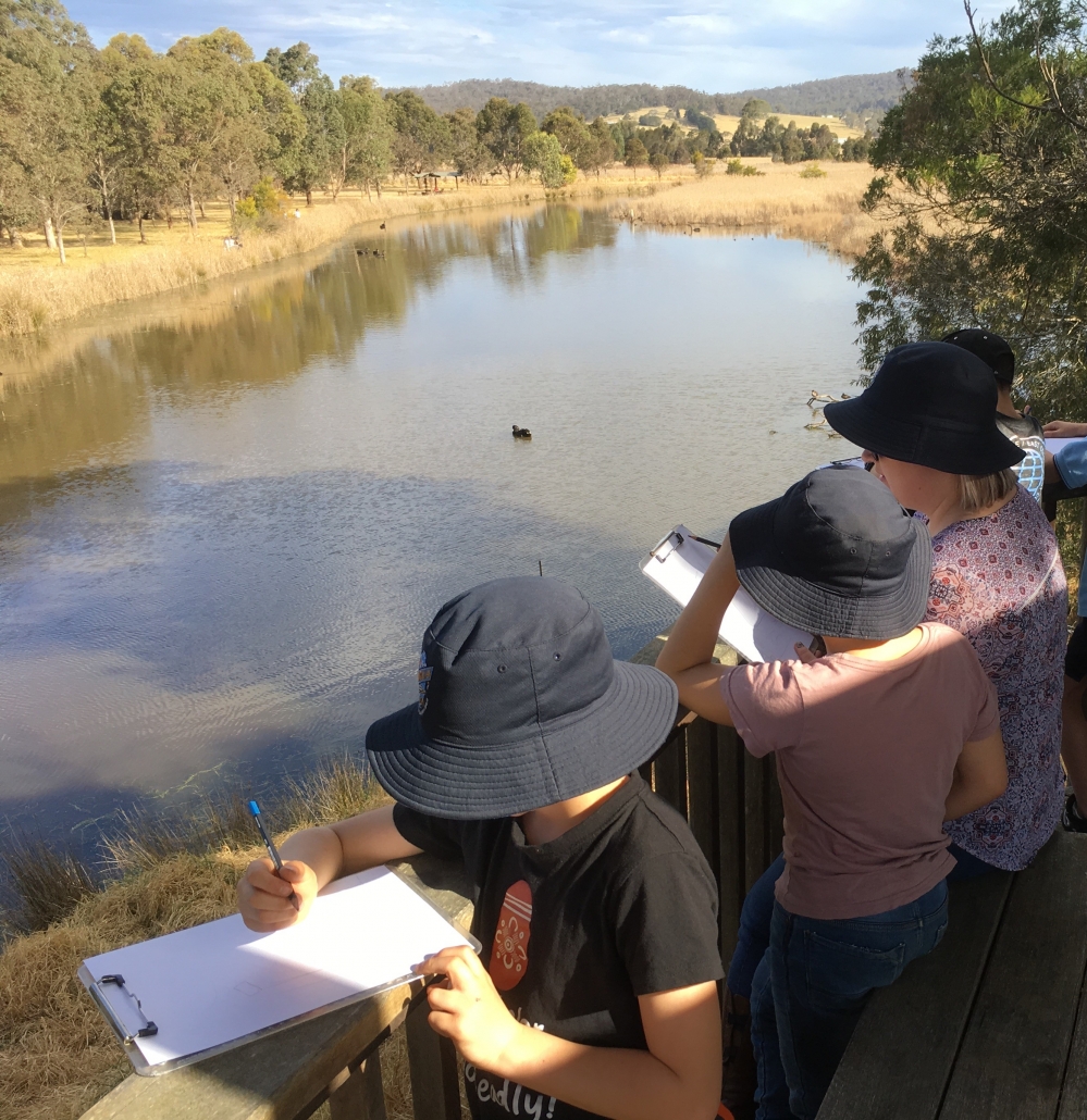
Within the 82-hectare project, students can identify a variety of different types of natural habitats e.g. floodplain forest, freshwater billabong, saltmarsh, shrubland as well as agricultural land. Bird surveys have been conducted in each of these ecosystems over the 20-year rehabilitation period of Panboola and this data allows students to discover the importance of natural vegetation to animals and the functioning of the environment. During an exploration of the site students will record their own data on bird and other animal species and their habitats as well as investigating the ways Panboola is being managed.
During the day’s activities students will use geographical tools appropriate to their stage to acquire, process and communicate geographical information. This will include maps, fieldwork, graphs and statistics, spatial technologies and visual representations.
Key Questions
How do people and environments influence one another?
How do people influence places and the management of spaces within them?
Learning Experiences
Activity 1 – How people can change the environment: case study of Panboola
Students will investigate the sustainable practices that have led to the protection and rehabilitation of the Panboola site. By examining photographs and data collected over the last 20 years students can see how people can change environments in a positive way. Students will also learn about the long-term land changes at Panboola, before and after early settlement in the area. A variety of maps will be used to show how the landscape at Panboola has changed. Students will complete some fun activities to learn how to use a map, compass and GPS.
Activity 2 – Exploring the diverse ecosystems of Panboola
Students will use bird survey data collected over the last 20 years to investigate the importance of natural vegetation to the environment and animals. Students will then explore Panboola using a GPS to locate four different ecosystems – floodplain forest, freshwater billabong, saltmarsh and open grassland. They will collect their own data on the birds, mammals, invertebrates and reptiles present, as well as identifying the different types of vegetation at each site. Students will also collect data on the possible threats to the biodiversity at Panboola and what management strategies are in place at the site to help protect it.
Activity 3 – How can we use our places and environments more sustainably?
Students record data they have collected against each of the ecosystems visited and re-visit the bird survey results and maps discussed earlier in the day. Students discuss how changing the landscape has affected the environment, the animals who live there and the humans who visit. They list the management strategies in place and role play people with a variety of views on the management of Panboola.
Panboola is an example of how people can use places and environments more sustainably. The concept of sustainability, the capacity of the environment to continue to support our lives and the lives of other living creatures in the future, will be explored. Students will work in small groups to come up with an action plan as to how they can be more sustainable at their own school. In our changing world, students can benefit from recognising that they have the power to make positive change in their own lives.
Post visit support from Bournda EEC
Bournda EEC can support teachers and students back at school to work on their action plans and to use a design thinking process to turn these actions into reality.
‘Design thinking is a process where a need or opportunity is identified and a design solution is developed. The consideration of economic, environmental and social impacts that result from designed solutions are core to design thinking. Design thinking methods can be used when trying to understand a problem, generate ideas and refine a design based on evaluation and testing.’ Science and Technology K-6 Syllabus.
Contact BEEC for more information.
Preparing for an Excursion
Syllabus Outcomes
Geography K-6
• Students describe the diverse features and characteristics of places and environments (GE3-1)
• Students explain interactions and connections between people, places and environments (GE3-2)
• Students compare and contrast influences on the management of places and environments (GE3-3)
• Students acquire, process and communicate geographical information using geographical tools for inquiry (GE3-4)
Differentiation adjustments for high potential and gifted students
Higher Order Thinking – Are there other places in our community that we could use more sustainably? What lessons could we learn from the development of Panboola that could help us to care for other places? Use six thinking hats for a deeper analysis.
Complexity – How can we share with others the value of Panboola? Do different people value protected places in different ways?